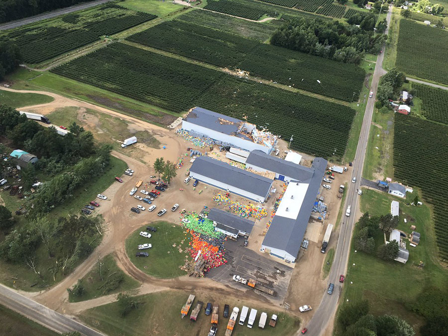
The National Weather Service confirmed that at least one of the several tornadoes that were reported in Michigan on Saturday was tagged in an EF-1 category. The group of tornadoes spawned from a line of strong thunderstorms that caused some floods. Tornadoes destroyed rooftops, cars, and power lines but no casualties have been reported.
Ten tornadoes hit Michigan and other states Saturday night, according to The Weather Channel. The EF-1 tornado touched down in Orleans, Michigan. Peak winds were estimated to be 90 m.p.h. Western Michigan was the most affected area. Luckily, no injuries or the loss of human lives were reported. The Detroit News says that Van Buren, Allegan, Kent and Grand Rapids were the worst affected territories. Wyoming area suffered considerable damages as well.

The director of the Kent County Emergency Management Department, Jack Stewart, stated that a command center was established in Wyoming, on 36th Street and Byron Center Avenue. Police officers and firefighters have urged people to stay at home to allow crews to take care of fallen trees and power lines.
MLive reports that the tornado began in Van Buren County and before reaching Southwest Kent County about 2:15 p.m. Saturday, the tornado cut the mid-section of Allegan County.
But the Weather Channel said that of the ten tornadoes, apparently only two touched down. The first tornado struck at 1:15 p.m. at Bangor in Van Buren County. Then it was followed by another one that touched down at 1:45 p.m. five miles southeast of Fennville in Allegan County.
A third tornado reportedly struck at 2:23 three miles west-northwest of Dorr in Ottawa County, and a fourth tornado was spot three miles north-northwest of Byron Center in Kent County.
State Police spokesperson Dale Hinz stated that the damage from the storm affected about 20 miles of urban areas, from south of Bangor to the small community of Grand Junction, which is around 60 miles southwest of Grand Rapids.
Northeast Grand Rapids Perkins Avenue and Leonard Street suffered heavy damage. Multiple trees and power lines also fell when the tornado passed the area at 2:45 p.m.
WZZM reports that these tornadoes left at least 21 thousand people without power in Allegan, Barry, Kent and Ottawa counties since the storm, and several rooftops were ripped off. Firefighters worked hard to identify wires and trees to let passengers go through roads.
Images of a tornado touchdown today north of Dayton near Piqua, OH. #3weather #ohwx https://t.co/TrwiC11vWM pic.twitter.com/nAYVI6zEOX
— Greg Dee (@GregDeeWeather) August 21, 2016
More tornadoes in Ohio and Indiana
According to the Weather Channel the Delaware Sheriff’s Office, Ohio, confirmed a tornado struck at Delaware State Park on Saturday before 7:00 p.m. WDTN reported that Darke, Auglaize, Shelby and Miami County has some damage. The National Weather service is surveying the area for damages.
And in Indiana a tornado touched down in Allen County, says the National Weather Service of Northern Indiana. None of the tornadoes cause any harm to humans, so far.
Jack Stewart explained that the community is well prepared for this kind of natural phenomena and believes that people respond appropriately. Tornado and thunderstorm warnings were issued.
Source: Weather
